Leveraging regional cooperation to promote space applications for sustainable development
Inputs to UN-Space Publication 2022: Economic and Social Commission for Asia and the Pacific (ESCAP)
In 2018, ESCAP members and associate members ramped up regional cooperation on space applications to help advance the Sustainable Development Goals by adopting the
Asia-Pacific Plan of Action on Space Applications for Sustainable Development (2018-2030). The Plan of Action provides a blueprint to harness space technology, geospatial information, and digital innovations towards advancing the 2030 Agenda for Sustainable Development. It includes 188 actions in six priority thematic areas, namely: (a) disaster risk management; (b) natural resource management; (c) connectivity; (d) social development; (e) energy; and (f) climate change.
In addition to implementing actions at the country level, countries have been participating in several regional initiatives to exchange technical expertise and experiences and to address the capacity building gaps expressed by countries. Some of the ongoing initiatives are described below:
- The ESCAP Regional Drought Mechanism - implemented since 2013 - is a recognised successful South-South cooperation story. Under the Plan of Action, the ESCAP Regional Drought Mechanism has widened (in terms of the number of countries participating) and deepened (in terms of drought monitoring coverage and derivative applications) through the regional service nodes operated by China, India, and Thailand. It has also expanded to Central Asia with support from the Russian Federation.
- The tools available through the Regional Drought Mechanism demonstrate the integration of ground and space data, as well as the engagement of young professional officials in line ministries to build their capacities. The Mechanism has adopted an explicit focus on engaging user sectors, notably agriculture, livestock and water management and has supported research and training of young professionals. Closer collaboration with users resulted in more user-oriented products and services. The national system set up by Mongolia demonstrates how the data and DroughtWatch tool available from the Regional Drought Mechanism could transcend beyond monitoring drought as a physical phenomenon towards forecasting and cascading effects of drought on dzud through the integration of big data and other innovative digital applications. With intensive capacity building activities including training workshops, fellowships, on-the-job practices and joint field works, the Mongolia Remote Sensing Center is now able to calibrate the model by itself and has even provided technical assistance to other countries, including Kyrgyzstan. The work of Central Asian countries shows how this could be used to predict drought impacts on wildlife, forest fire and crops.
- In South-East, North and North-East Asia, the Pan-Asia Partnership for Geospatial Air Pollution Information is boosting the capacity of over 10 countries to monitor and manage air pollution through the application of integrated surface-based data from Pandora spectrometer instruments and satellite data from the Geostationary Environment Monitoring Spectrometer developed by the Republic of Korea. Building capacities, in particular, those of young officials in space and environment authorities, to improve operational monitoring could potentially inform future efforts to increase regional cooperation to address air pollution.
- In North and Central Asian countries, institutional capacity to carry out land monitoring and accounting is being enhanced by a project that assists them in integrating satellite imagery with official socio-economic statistics. Supported by the Russian Federation, participating countries have improved their capacity to use open-source mapping and programming tools to compile land statistics in the format prescribed by the United Nations System of Environmental-Economic Accounting. The project has successfully demonstrated how geospatial information could be used to bring together multiple sectors, such as urban planning and management, water management, and forestry, in establishing land accounts.
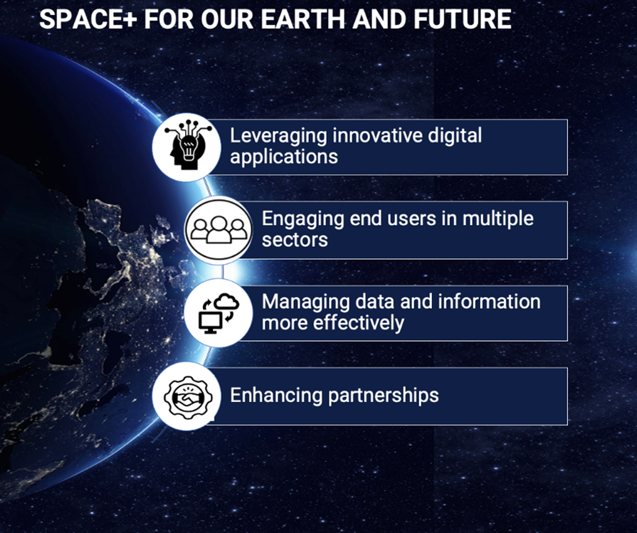
The phase II of the Plan of Action (2022-2026) has just kicked off. Efforts have focused on enabling countries to harness the power of space-derived data and services is vital for the achievement of the Sustainable Development Goals and for building back better from the COVID-19 pandemic. To address emerging needs in the current context and in recognition of the fast-changing regional context of space applications, guided by the theme "Space+ for our Earth and future" which consists of four elements, namely leveraging innovative digital applications; engaging end-users in multiple sectors, and the youth; managing data and information more effectively; and enhanced partnerships with global, regional, and national stakeholders. Together they transcend traditional approaches by promoting innovative applications of space technology and geospatial information in tandem with digital innovations, research, knowledge sharing and capacity building.
ESCAP and the Government of Indonesia will co-organise the Fourth Ministerial Conference on Space Applications for Sustainable Development on 26 October 2022 in Jakarta to sustain and reinforce regional cooperation with a view to expanding access to and the peaceful use of geospatial information and space technology applications for sustainable development in Asia and the Pacific. Further details will be uploaded as they become available from: https://unescap.org/events/2022/fourth-ministerial-conference-space-applications-sustainable-development-asia-and
Contact:
Keran Wang (kwang[at]un.org)
Kareff Rafisura (rafisura[at]un.org)
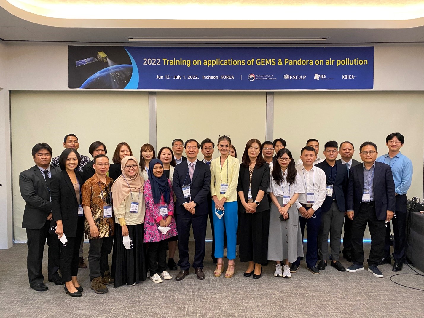
Photo 1: Training for participants from Asian countries in the integration of GEMS satellite-derived data and Pandora instrument for monitoring air pollution at the Environmental Satellite Center of the National Environment Research Institute in Incheon, Republic of Korea.
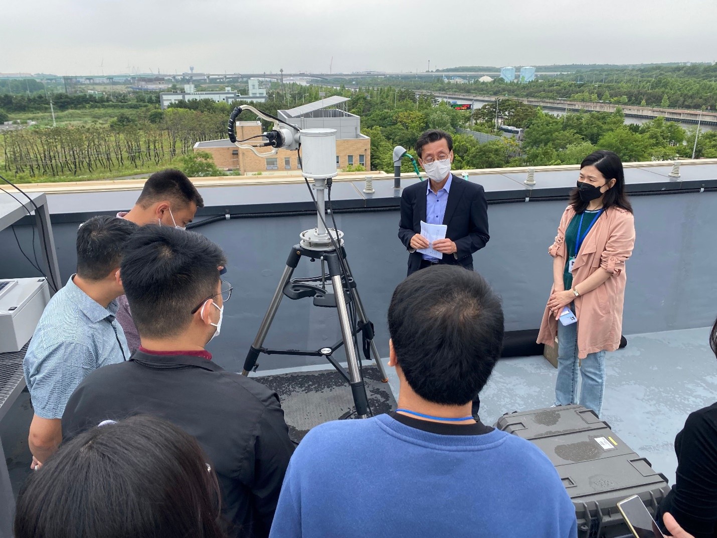
Photo 2: Pandora instrument installation and operation demonstration on the roof top of the Environmental Satellite Center in Incheon, Republic of Korea.