Inputs to UN-Space publication 2022: UN Global Pulse
Overview
UN Global Pulse has been working closely for many years with partners across the UN System to investigate ways in which Artificial Intelligence can be applied to satellite image analysis. This has led to numerous efforts, including the development of PulseSatellite which was co-created with UNOSAT - the UN's Satellite Center.
PulseSatellite is a collaborative satellite image analysis tool which leverages neural network models that can be retrained on-the-fly and adapted to specific humanitarian contexts and geographies. The tool now has numerous AI models loaded into it - including for the rapid mapping of buildings and floods - and we are seeking to expand into more use cases in the future.
We are also working closely with UNOSAT to develop benchmarks datasets for shelter (refugee camp) mapping, building footprint detection and damage assessment. We plan to use these to test the increasingly numerous models which are becoming available for these tasks, but in the context of UN-focused datasets - often covering different geographical regions to where the models were trained to perform well on.
Finally, we are applying much of our learnings in this space to other areas. This includes our ongoing project with an interagency data science working group to map out and document how we are using data science, and especially satellite image analysis, in the aftermath of crises. As a group, we seek to identify challenges and lessons learnt, as well as guidance so that we can continue to improve how we help those most vulnerable when crisis strikes.
Highlight: PulseSatellite
PulseSatellite is a collaborative satellite image analysis tool which leverages neural network models that can be retrained on-the-fly and adapted to specific humanitarian contexts and geographies. The tool was developed in close collaboration with UNOSAT.
Since the project's inception in 2017, PulseSatellite has expanded to become a web-based toolkit that can be easily adapted to numerous remote sensing applications and which allows for the incorporation of models created by other users. Currently, we have three active models - one that allows users to map structures in refugee settlements, a roof density detection model (e.g. for informal settlement mapping), and a flood mapping model.
The flood mapping model has been deployed by UNOSAT to identify areas affected by flooding around the world, including in Nepal, Mozambique and Bangladesh, and led to the first flood map co-generated by an AI to be released by the UN. Using the model has shown to significantly reduce the time required to produce maps in the aftermath of a crisis, thereby enabling responders to act more quickly.
We are also currently investigating the use of the shelter (refugee camp) mapping model, in collaboration with WHO, to map refugee settlements for the purposes of population estimation and informing resource planning for public health programming.
PulseSatellite is open for use by other UN agencies. In future work we will continue to work with end users to test and help refine the PulseSatellite, and expand into more applications and use cases.
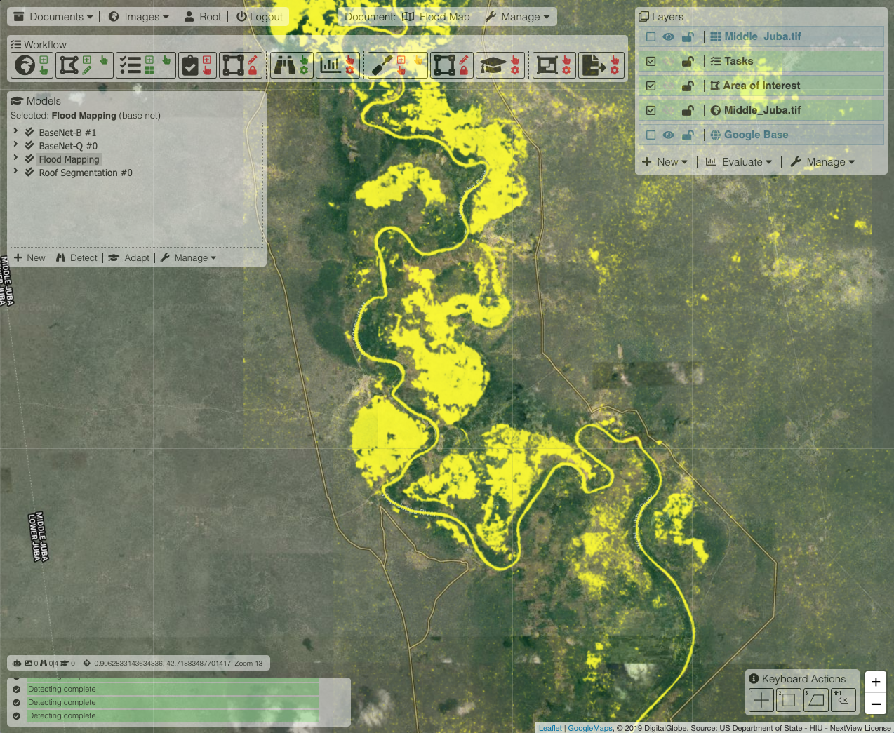 Flood Mapping
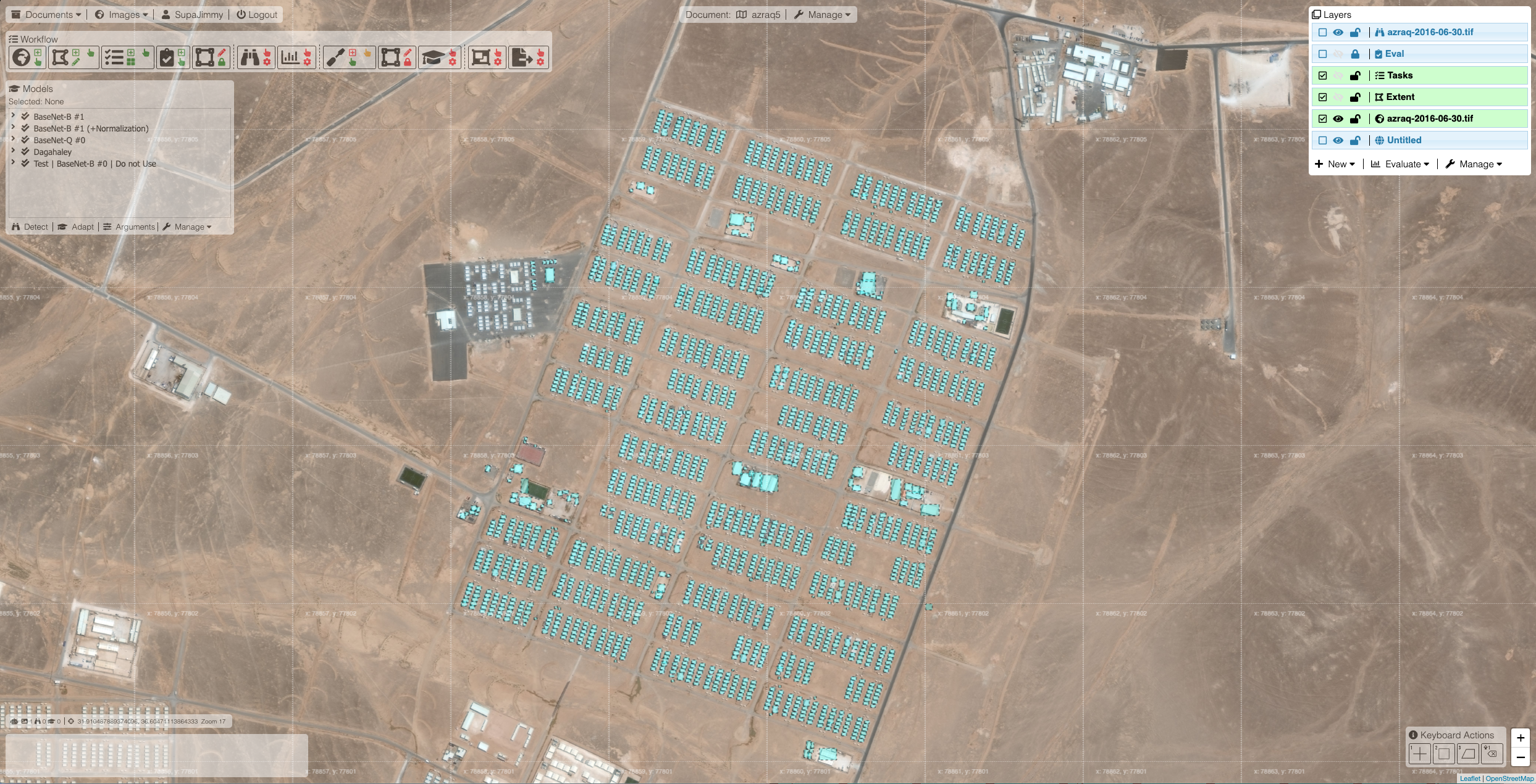 Refugee Camp Mapping
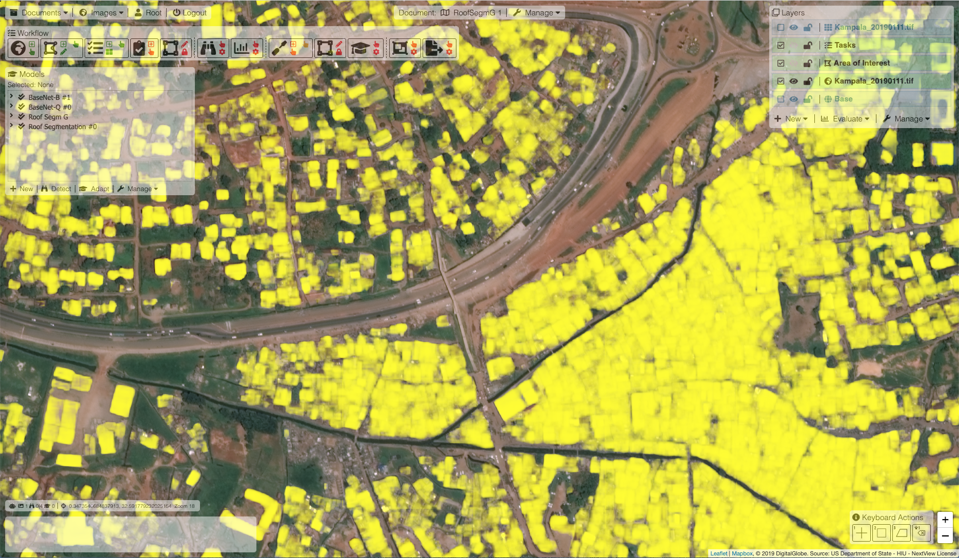 Roof Segmentation
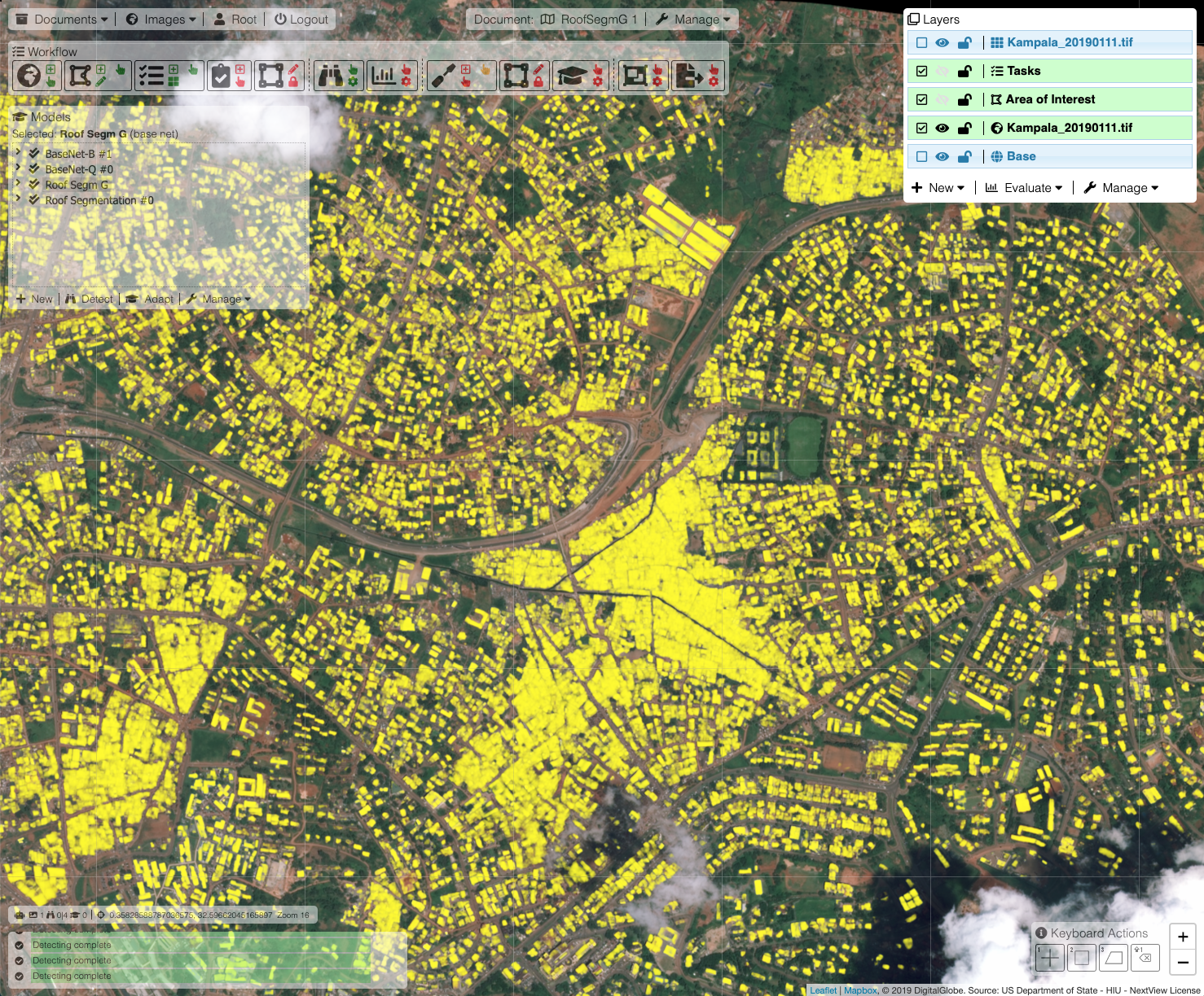 Roof Segmentation