Inputs to UN-Space publication 2022: United Nations Office on Drugs and Crime (UNODC)
Monitoring of illicit activities
Illicit activities like illicit crop cultivation, illegal logging and mining can be best monitored using remote sensing techniques and space-based technologies. Since the start of the Illicit Crop Monitoring Programme in 1999, UNODC has processed thousands of satellite images. First by using Landsat and SPOT imagery, but as soon as Very High-Resolution imagery became available, the programme included these to identify the small fields with opium poppy, coca or cannabis used for drug production. Cars, planes and helicopters equipped with Global Navigation Satellite Systems are used to tag ground truth pictures and to locate production sites. The annual statistics generated for the main producing countries form the base to estimate global opium and cocaine production, to define drug, as well to evaluate alternative development programmes. Geospatial experts at UNODC Headquarters and field-offices assist in the use of satellite technology.
The use of georeferenced aerial images to complement satellite image analysis
Images from aerial vehicles have been an important component as an alternative for satellite images, for example in cloudy environments, or to complement monitoring activities that use satellite imagery. Traditionally, planes and helicopters were important means to obtain aerial photos for example in the case of the Mexico opium surveys and Nigeria cannabis survey.
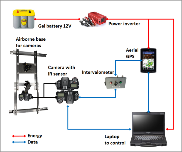
System to take aerial photos with a handheld camera linked to a GNNS system used for the Mexico opium survey
Analysis of satellite images complemented by aerial photos to detect opium poppy fields in Mexico
Spot-7 Image
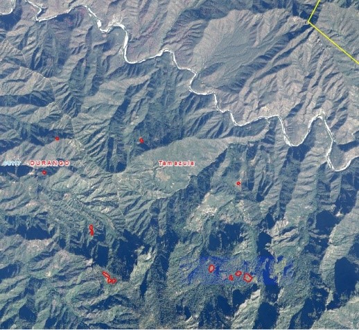
Image from January 2, 2016
Aerial photograph
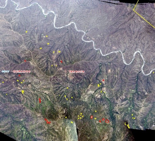
Image from February 13, 2016
In the past years, the use of Unmanned Aerial Vehicles (UAVs or drones) has become an affordable way to collect data to locate and measure illicit activities. Images taken with UAVs equipped with GNSS are easily transformed into useful geographic data, for example to verify operations that try to limit coca cultivation in Bolivia and Colombia.
UNODC also supports research for using drones to take hyperspectral images, for example to detect cannabis and Ephedra plants in Central Asia, a plant used for the production of crystal methamphetamine, a drug increasingly used in the world.
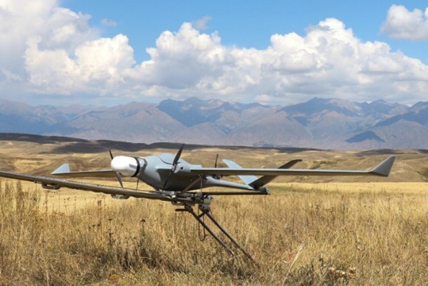
Drone used to take hyperspectral measurements of crops that can be used for drug production
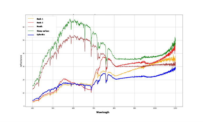
Comparison of reflectance values for Ephedra versus other land cover types using hyperspectral imaging.
The technology to monitor cultivation with hyperspectral sensors helps to improve the detection of specific drug production varieties, as well of illegal mineral mines. With the expected growth of satellite sensors that include hyperspectral data, this technology has great potential to be applied in monitoring large areas.
United Nations Office on Drugs and Crime (UNODC)
Vienna International Centre
Wagramer Strasse 5
A 1400 Vienna
www.unodc.org